Fire and Rescue NSW is using drones to capture the location of flood debris in Northern Rivers cane fields.

Fire and Rescue NSW
Repeated flooding in the region has left all manner of objects stranded on the region’s farms, with minister for flood recovery Steph Cooke saying “Items like fridges, washing machines, gas cylinders, shipping containers and even a swimming pool are being found in cane fields across the Northern Rivers."
“This sort of debris could damage farming equipment like harvesters and risk ruining harvest season activities, which is the last thing our growers need after being impacted by the floods.”
FRNSW is deploying remotely piloted aircraft systems (RPAS) – drones – originally purchased with funding provided after the Black Summer bushfires.
Two teams of drone operators from FRNSW’s Bushfire and Aviation Unit have been in the Northern Rivers to identify and map the location of dangerous debris.
“We conduct reconnaissance flights using smaller drones and if they identify dangerous or bulky waste material, we send up the larger RPAS which can pinpoint the size and location of the debris,” FRNSW deputy commissioner Megan Stiffler said.
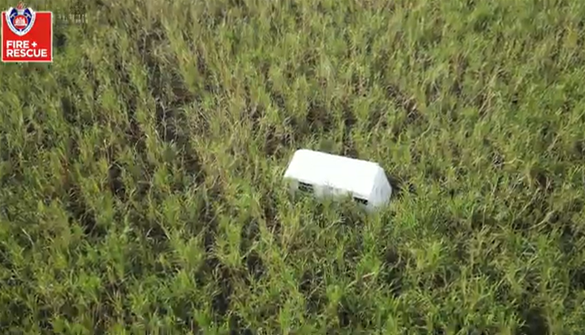
“Once we process the data, we can send QR codes to the cane growers, which then provide them with real-time maps of their properties, identifying where the obstacles are located.”
The growers can then remove the debris with the help of Resilience NSW and the Environment Protection Authority.
The expansion of FRNSW’s RPAS unit followed the release of the 2020 report into the Black Summer bushfires.
The response to that report also included expanded mapping capabilities.
Earlier this month, the drone unit was used to provide flood assessments in Sydney’s north-west.
Their footage provided real-time assessments of flooded roads, access points, critical infrastructure, and damage to homes and buildings, and helped SES commanders prioritise door-knocking and evacuation operations.


